 |
| Kashṭa Harṇi Ghāt (pain-expelling bathing place), River Gangā, Munger. |
During his stay and pilgrimage to India, Xuanzang visited a country called Īraṇaparvata. Stanlais Julien translates Īraṇaparvata as Hiranaya Parvata, meaning golden mountain, whereas Thomas Watters translates it as Īraṇa (Parvata), meaning wild or barren land (Watters 1905: 179). Xuanzang travelled to Īraṇaparvata from Nālandā, passing via Indraśailaguhā Mountain, Kapotaka (‘Pigeon’) Monastery, and Lāvaṇīla Village (also known as Lo-pan-ni-lo). The capital city of Īraṇaparvata was located by the bank of the Gangā. There were more than twenty Deva temples (i.e. Brahmanical shrines) and approximately ten Buddhist monasteries with over four thousand monks, mostly belonging to the Saṃmitīya school.
According to Xuanzang Īraṇaparvata was a Buddhacārikā site, i.e. the Buddha visited this kingdom. Xuanzang saw a stūpa to mark the place where the Buddha preached for three months. To locate this Buddhacārikā stūpa mentioned by Xuanzang, I visited Munger on 29th March 2024. The stūpa, according to Xuanzang, was located south of the capital city. However, Xuanzang did not specify the distance from the City. This could be the reason why Alexander Cunningham and Bolch in their exploration reports of Munger didn't mention if they tried to locate this stūpa (Cunningham 1882; Bloch 1903).
It is my observation that the Buddhacārikā stūpas mentioned by Xuanzang were mostly 4 to 6 Li (i.e. 1-2km) from the capital city. For example, in places like Kannauj, Navadevakula, Ayōdhyā etc., the stūpa to mark the visit of the Buddha according to Xuanzang was within 6 Li from the capital city (Beal 1914; Watters 1904; Rongxi 1996). One or two kilometres away from the city was usually the ideal distance for the Buddha to preach the meditative teachings to his disciples. This distance was sufficient to avoid the city's bustle and commotion while also remaining close enough to collect daily morning alms.
I expected the stūpa in question to be within 1-2 km from the capital city. The capital city, according to Xuanzang was near the River Gangā and Īraṇa Mountain. Cunningham has identified historical Modagiri/ Mudgalgiri/Kashṭa Harṇa Parvata situated south and east of the river Gangā as the Īraṇa Mountain (Patil 1963: 278). Therefore, this capital city was situated east of Modagiri (now the Munger Fort) cuddled between the Gangā from the east, north and west sides. The capital city was 20Li (i.e. 4-5kms) in the circuit. We do not have an archaeological profile of the modern city of Munger to determine the exact situation of the ancient capital city, however, it is conceivable that the ancient capital was located in the current areas between Munger Fort and Purabsarāi, and the areas situated around the Munger Railway Station (refer to Map.2).
During my on-field research of several ancient Buddhist sites, I've noted, that the Buddhist stūpas and shrines are usually surrounded by water bodies. These water bodies are formed when the earth is excavated to make bricks to be used for the construction of these Buddhist shrines. Using these water bodies as my reference point, I began to explore Google Earth to find water bodies in Munger. My areas of interest were the ponds situated 1-2km south of Munger Railway Station. I noticed some ponds in the areas around Sandalpur. Sandalpur is 1-2km south of Munger Railway Station. I pinned all water bodies in and around Sandalpur (refer to Map.1). I started my physical exploration with a big Mango orchid near Bindwara crossing on the Jamalpur-Munger highway as it had two water bodies but I discovered these ponds were not ancient. I visited some more water bodies as I walked a few miles ahead towards Mangrā Pokhar, Siddhi Pokhara and Sandalpur, even still could not find the existence of any archaeological mounds around these water bodies. While having a dialogue with the locals on the same, the locals from Mangrā Pokhara and Siddhi Pokhara directed me towards Kabir Maṭh (monastery) which is a conspicuous mound, situated on the west of the Munger-Jamālpur railway line and east of the village Sandalpur.
 |
| Map.1.Waterbodies and potential places for exploration marked on the Google Earth map. |
 |
Kabir Maṭh mound is concealed by vegetation and brick debris around it. West side. |
 |
Kabir Maṭh mound in the middle of Agriculture fields. South side. |
 |
Kabir Maṭh mound is concealed by vegetation and brick debris around it. East side. |
I reached the place, ‘Kabir Maṭh’ mound (25° 21' 42'' N. 86° 29' 19'' E) which stood 12-15 feet high and spread over a half acre of land surrounded by agricultural fields. The mound has ancient brick debris on all sides. The top of the mound is flat and a dilapidated two-room monastery (Kabir Maṭh) sits on the western part of the mound. Shri Vijay Dās, the Mahant (chief abbot) of the Maṭh welcomed me with anxious eyes. I explained to him the purpose of my visit. I told him that I was looking for a Buddhist stūpa and that according to the 7th CE Chinese monk-scholar Xuanzang, it should be precisely located in this area. Vijay Ji confirmed that the information was correct.
The mound was originally a Buddhist shrine. Ten years ago, a researcher from Patna identified the mound as an ancient Buddhist shrine, documented it and informed Vijay ji of its historical significance. Through further inquiry, I discovered that Manas Kumar conducted an archaeological survey of the Munger district for the K.P. Jayiswal Institute, Patna ten years ago. I called Manas, but unfortunately, he was not keeping well for three months. He vaguely recalled visiting Kabir Maṭh but didn't remember more details.
As I moved around the mound I noticed a ruined square structure right beneath the Kabir Maṭh. The structure was concealed by vegetation and brick debris around it. The brick debris surrounding the structure could be around 4 to 5ft high. The square structure, measuring approximately 100ft square and 10 to 12ft tall, featured dome chambers on its eastern and southern faces, with niches and blind arches. The remaining sides seemed collapsed and obscured by debris and vegetation. Despite intact domes, their entrances were collapsed. A staircase on the southern side led to a terrace with a central dome. Amit Kumar, a resident of the village of Sandalpur guided me through the narrow tilted entrance inside this central dome. The chamber measured about 8-9ft in radius. The central dome was covered by a 4 ft high octagonal brick platform, about 11 ft on each side. Vijay Ji told me that the octagonal platform was built on a similar octagonal brick plan- a part of the central dome. There were remains of some structures on four corners of the square terrace. The terrace was levelled without destroying the domes of the square structure. Fallen bricks from these structures were repurposed for levelling the terrace. The dilapidated Kabir Maṭh was built on the western half of the levelled terrace.
According to Vijay Ji, some old people in this area still referred to this site (square structure) as ‘Masjid’. This Masjid (square structure) was constructed using bricks of at least four different dimensions. The dimensions of the bricks found at this site are:
(i) 5.5in long x 1.25in thick
(ii) 6in long x 2.5in thick
(iii) 6in long x 2.1in thick
(iv) 3in thickness
Probably these bricks are recycled from anterior structures at this place. The bricks with 3in thickness found either in the structure or lying in the debris were mostly all fragments. As per Dr Sujeet Nayan, SA, Patna Excavation Branch, Archaeological Survey of India (ASI), the 3in bricks could be from the Sunga-Kushan period (1st BCE-2nd CE). Xuanzang does not specify dimensions for the Buddhacārikā Stūpa in Munger, unlike other places where he mentions their sizes as 100ft or 200ft. Probably because this was comparatively not a large stūpa.
Prima facie it appears that the Kabir Monastery was built on top of the ‘Masjid’ without demolishing it. Vijay ji informed me that this mound was once a Buddhist shrine. It then became a Brahmanical shrine. Later, the Brahmanical shrine was converted to a Muslim shrine, i.e. the present square structure. This is what Manas Kumar informed Vijay ji after conducting an archaeological survey of the mound. As per Vijay Ji, the Masjid was abandoned at some time in the past and the Kabirpanthi people then established a monastery some 150 years ago.
 Map.2. Kabir Maṭh WRT Munger Fort, Railway Station and the ‘ancient city’.
  |
Dome chambers of the Masjid are collapsed and obscured by debris and vegetation. |
 |
| Dome chambers of the Masjid are collapsed and obscured by debris and vegetation. |
 |
Niche with some plaster. Square structure (Masjid). |
 |
| Wall of the Square structure (Masjid) with some thick plaster. |
 |
Blind arch covered by debris.Square structure (Masjid). |
 |
| A fallen portion of the Masjid Wall. |
 |
| Sandstone Pillars/blocks reused by the Kabir Maṭh. |
 |
| Sandstone Pillars/blocks reused by the Kabir Maṭh. |
 |
| Sandstone Pillars/blocks reused by the Kabir Maṭh. |
 |
| A modern octagonal platform built on a similar octagonal brick plan- a part of the central dome of Masjid. |
 |
| Narrow obstructed entrance of the octagonal platform built oover the central dome. |
 |
Ancient bricks of different dimensions were used in the Masjid Wall. |
 |
| A three inch thick brick. |
 |
| A three inch thick brick along with brick of two inch thickness |

 |
| Ancient bricks of different dimensions were used in the Masjid Wall. |
 |
| Six inch long brick. |
 |
| A Two inch thick brick. |
 |
| Two and a half inch thick brick |
 |
| Amit Kumar and myself holding ancient bricks. |


 |
| Ancient bricks of different dimensions. Kabir Maṭh |
 |
| A sculpture-shed west of Kabir Maṭh. |
 |
| A broken ancient sculpture in the sculpture-shed west of Kabir Maṭh. |
 |
| A sculpture from 8th-10th CE depicting a hunting scene. The sculpture-shed west of Kabir Maṭh. |
 |
| The Water body is now encroached and silted. |
 |
| Map.3. Kabir Maṭh and the water body. |
The Sandalpur area was a forest and mango grove until city dwellers settled there after a plague in the early 20th century. The mound is presently 12-15ft high but the foundations of the first structure (i.e. the Buddhacārikā stūpa) may go up to 10ft below the present level of surroundings. The mound is situated 2.5 km from the river Ganges. Centuries of silting due to floods may have buried a part of the stūpa. I also spotted sandstone blocks of different sizes on the mound, which according to Vijay ji were part of the Masjid. I noticed a few spots of thick plaster on the Masjid's outer wall. The plaster was almost preserved behind the niches, blind arches and interior walls of the domes. My archaeologist friend Dr Harsha Ranjan Kumar (Directorate of Archaeology, Government of Bihar) is of the view that this plaster should be around 150-200 years old. This suggests the Masjid may be around 200 to 250 years old.
My experience so far is that ancient Buddhist shrines are mostly accompanied by waterbodies. Vijay ji informed me about the presence of an ancient waterbody west of the Maṭh mound (refer to map.3). The water body is called ‘Dobhi Ghāt’ because until a few decades ago few Dhobi (traditional washerman) families lived by the pond. The water body was dried and had an irregular border because of encroachment. Less than one acre of it now survives. Centuries of silting have caused this pond to be shallow with a meagre water storage capacity. This could be the reason why I could not trace it on the Google Earth map.
Beside the Buddhacārikā Stūpa, Xuanzang saw ruins where the three past Buddhas sat and walked up and down. And, a little west of this Xuanzang saw a stūpa marking bhikṣu Śrutaviṃśatikoṭi’s birthplace. I inquired with a few locals, but they were unaware of any mounds in the region. I believe that these shrines were not huge and may have been lost to new settlements. Also, Sandalpur few decades ago was a flood-prone area. The shrine may be buried in centuries of silt deposited by floods. I noticed a few broken sculptures from 8-10th CE under a tree in Sandalpur village around 200mts West of Kabir Maṭh. This indicates some religious activity in this vicinity around the 1st millennium CE.
The Kabir Maṭh mound fulfils two important criteria; first, it is situated towards the immediate south of Munger city and second, the archaeological remains suggest it to be a very ancient site. I am convinced this is the site where the Buddha according to Xuanzang preached for three months. The existing remains narrate a complex history. The complete truth can be revealed only through a complete study by competent people. Hoping my research blog will be able to pull attention from archaeologists, scholars and authorities to intervene and further investigate this site and be able to revitalise the Buddhacārikā (Buddha's footsteps) as a part of a Buddhist Pilgrimage Circuit in the near future.
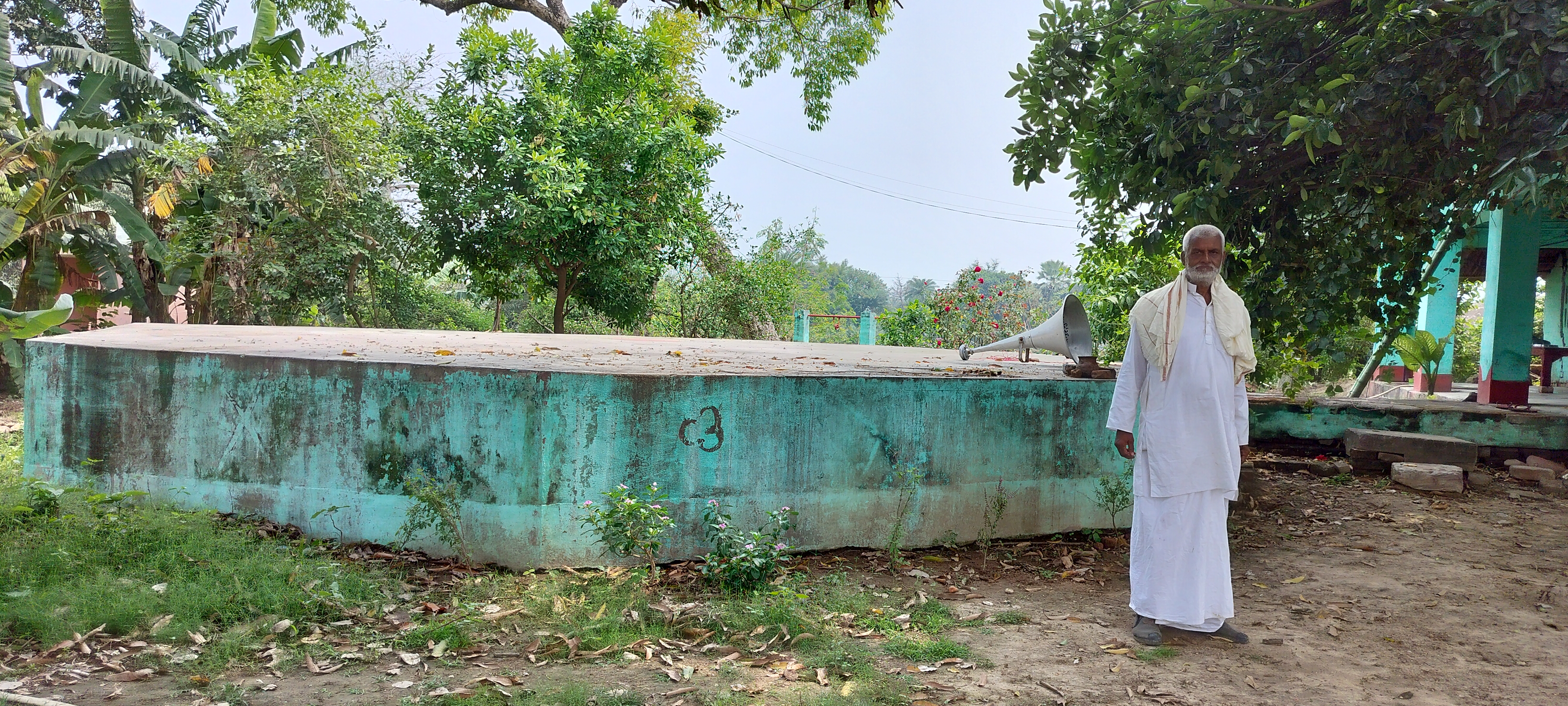
The Īraṇa Mountain in Munger, where Xuanzang records the Buddha lived and preached and what Cunnigham referred to as Modagiri hills, located within the fort area, only the tip of the Hill is visible known as Karna Chuḍa/Karna Chaura meaning Karna’s top-knot or seat of Karna (of Epic Mahābhārat). The place is now popularly known as Kashṭa Harṇi Ghāt (pain-expelling bathing place). I observed some Brahmanical sculptures plastered on the wall of steps leading to the Gangā. An image of Dhyani Buddha (1ft 9.75in X 9.50in) inscribed on the back with Buddhist creed was discovered here in 1862 by J G Pughe and presented to the Asiatic Society of Bengal. The Image is currently at the Indian Museum, Kolkata (Anderson 1883: 90-91). The presence of an image of the Buddha suggests that there was some Buddhist activity here near the Kashṭa Harṇi Ghāt.
 |
| Mazār of Peer Shah Nafā situated on the ancient mound. |
 |
| Kashṭa Harṇi Ghāt. |
 |
| An ancient inscription fixed on the wall. Kashṭa Harṇi Ghāt. |
 |
| An ancient broken sculpture fixed on the wall. Kashṭa Harṇi Ghāt. |
 |
The tip of the Īraṇaparvata Hill is visible and known as Karna Chuḍa/Karna Chaura. |
Before Xuanzang's visit to Īraṇaparvata, the King from the neighbouring kingdom deposed its King, and gifted the capital city of Īraṇaparvata to the monk community. Subsequently, two Sarvāstivāda monasteries were established in the city. Xuanzang stayed here for one year and studied Vibhāshā and the Nyāya-Anusāra and other Sāstras under eminent teachers Tathāgatagupta and Kshāntisiṁha. Though Xuanzang has mentioned Buddha stayed and preached at Īraṇaparvata but does not mention a shrine to mark the presence of the Buddha on the Hill. A huge mound is observed on the eastern end of Munger Fort on which currently stands the Mazār of the 12th CE Muslim saint Peer Shah Nafā. This mound, a solid brick structure could be remnants of an ancient Buddhist stūpa or a Brahmanical shrine.
As per the Pali sources and Faxian (Fa Hien, 337-422 CE), Champā (i.e. present-day Bhagalpur region) is most likely the easternmost Buddhacārikā site (Beal 1869: 147; Vin.i.312; S.i.195; A.iv.59). However, Xuanzang in his visit to Champā has not mentioned it to be a Buddhacārikā site. As per Xuanzang, Munger is the easternmost Buddhacārikā site.
I hope someday we will have a shrine to commemorate the Buddha's association with Munger. Munger Fort (Īraṇaparvata) is an ideal place for a commemorative stūpa to honour Munger as a Buddhacārikā. After discussing with Vijay Ji about installing a Buddha image at Kabir Maṭh, he hesitated a bit, later after my assurances agreed to consider it further.
 |
| Kabir Maṭh. |
 |
| The delecious Dāl-Chāwal-Chokhā lunch offered to me by Shri Vijay Ji. |
 |
| Shri. Vijay ji, Chief Priest, Kabir Maṭh. |
The story is chronicled by Deepa Nandi.
Bibliography:
Anderson, John.; 1883, Catalogue and Handbook of the Archaeological Collections in the Indian Museum, Part II. Calcutta: Printed by the order of the Trustees.
Beal, Samuel.; 1914, The life of Hiuen-Tsiang by Shaman Hwui Li. London: Kegan Paul, Trench Trubner & Co. Ltd,.
Beal, Samuel.; 1869, Travels of Fah-hian and Sung-Yun, Buddhist Pilgrims from China to India. London: Trubner and Co.
Bloch, T.;1903, Annual Report of Archaeological Survey, Bengal Circle. Calcutta: Printed at the Bengal Secretariat press.
Cunningham, A.; 1871, The Ancient Geography of India - I: The Buddhist Period. London: Trubner and Co.
Cunningham, A.; 1882, Archaeological Survey of India. Report of a tour in Bihar and Bengal in 1879-80, Vol. XV. Calcutta: Office of the Superintendent of Government Printing.
Huntington, Susan L.; 1984, The "Pala-Sena" Schools of Sculpture. Leiden: Brill.
O'Malley, L. S. S.; 1909, Bengal District Gazetteers: Monghyr. Calcutta: The Bengal Secretariat Book Depot.
Patil, D. R.; 1963, The Antiquarian Remains in Bihar. Patna: K. P. Jayaswal Research Institute.
Rongxi, Li.; 1996, The Great Tang Dynasty Record of the Western Regions. California: BDK America, Inc.
Waddell, L. A.; 1891, Note on an inscription in Kutila characters, from a stone recently unearthed at Mudgal-āsrāma (Kashtharani ghāt) Mungir, with ink impression of inscription. Proceedings of the Asiatic Society of Bengal, January to December 1890. Calcutta: Asiatic Society, 57 Park Street.
Watters, Thomas.; 1904, On Yuan Chwang’s Travels in India. Edited by T. W. Rhys Davids and S.W. Bushell. Vol. I. London: Royal Asiatic Society.
Watters, Thomas.; 1905, On Yuan Chwang’s Travels in India. Edited by T. W. Rhys Davids and S.W. Bushell. Vol. II. London: Royal Asiatic Society.
Abbreviations of Bibliography:
Source of Pāli references: http://www.palikanon.com/english/pali_names/dic_idx.html
P.T.S. Means published by the Pāli Text Society.
SHB. Means published in the Simon Hewavitarne Bequest Series (Colombo).
Vin- Vinaya Pitaka, 5 vols., ed. Oldenberg (Williams and Norgate)
S- Samyutta Nikaya, 5 vols. (P.T.S.)
A- Anguttara Nikaya, 5 vols. (P.T.S.)